Skip to content

Hiking areas, tracks and nature trails

The hiking areas and trail networks of Kokkola offer an abundance of recreational outdoor experiences in a wide range of nature sites. 
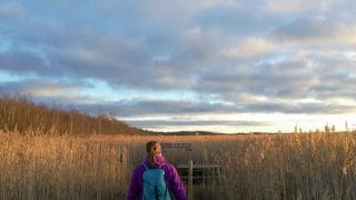
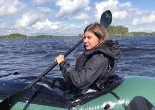
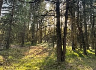
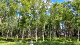
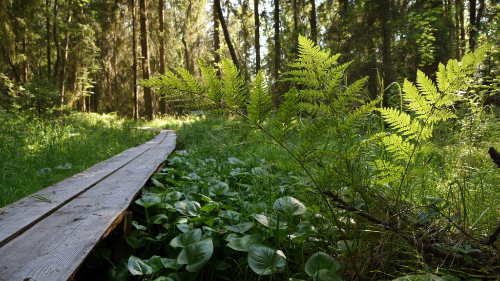
Perhaps you would like to head out to sparkling waters or immerse yourself in the gloomy tranquillity of ancient spruce forests? There are rest areas along the trails both in far-off locations and in more easily accessible places. Some of the trails are perfectly suited for families and persons with disabilities.

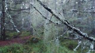
The hiking trails are marked in the terrain with hiker signs and nature trails with pinecone markings. The trails are marked well to ensure that no-one gets lost and that everyone can enjoy the local nature – with or without a map. There are also nature information boards along the trails introducing visitors to the nature, animals, plants and cultural history of the area.

  • Show on map

    Isokari is accessed through Lahdenperä industrial estate. From Pohjoisväylä turn to Kölitie road, continue left to Lahdenperäntie road and turn immediately to the right to Isokarintie. The parking area is at the end of the road. The trailhead is on the right-hand side of the parking area when approaching along the road. There is a pedestrian and cycle path next to Pohjoisväylä road.

    Isokari island, also known as Friisinsaari, is located on the southwest coast of the Ykspihlajanlahti bay. The total size of the island is 5.4 hectares. It is a historically significant destination and a popular recreational area and hiking site.

    Nature trail

    Accessible trail – The initial trail section along duckboards is accessible as far as the boulder. There is an accessible toilet at the start of the trail. The duckboard trail has handrails and seats. Hikers return along the same trail, the length of which is 0.1 km in one direction.

    Medium difficulty trail – The section around the island and paths leading to Isokari villas and the cellar. The trail is partially overgrown with grasses and slightly rocky. Some of the trail markings are missing.

    The nature trail (0.8 km) starts from the parking area located at the end of the road that circles the island. The trail winds its way around the island deep in the groves and forests, and it is partially suitable for persons with disabilities (wheelchair ramp). There are information boards along the trail introducing visitors to the history and nature of the island, and there is also a lookout point and a rest area.

    Services

    The birdwatching tower is located at the end of the causeway leading to the island, and it is a great place to observe the surrounding sea areas. There is a parking area next to the tower. There is also an information board and a map of the area by the road.

    Nature

    Isokari island is mostly covered with broadleaved deciduous trees. There is a large erratic bolder on the south-western beach. The island’s nature is dominated by the sea and lush grove-like forests. There are rocky coastal meadows on the northern shore. The island with its birdwatching tower offers visitors a great place to observe the birds at the Ykspihlajanlahti bay all year round.

  • Show on map

    Access

    From Vaasantie road, turn at the sign to Laajalahti bathing area and follow the signposts. The parking area is at the end of Hietanokantie road. Signposts in the parking area point to the nature trails and bathing area.

    The Laajalahti bay is located on the coast of Lake Öjanjärvi. This bird wetland belongs to the Natura 2000 network and covers an area of 266 hectares. With their swimming beaches and fitness tracks, Laajalahti and Hietanokka are among the most popular recreational destinations in Kokkola. The area is open to visitors all year round. In the winter, there is a ski trail that runs all the way to Koivuhaka. Visitors can move freely in the area under the Finnish everyman’s rights, while keeping in mind the restrictions in force at the swimming beach. Please consider the bird nesting season (from 15 April to 31 July) while hiking in the area.

    LAAJALAHTI SHORELINE TRAIL (1.7 KM)

    Difficult accessible trail – the initial section of the trail starting in Laajalahti parking area follows an easy duckboard path. There is an accessible toilet as well as a barbecue shelter along the trail. The trail section after the barbecue shelter follows a gravel-surfaced path. This is a circle trail marked with signposts.

    The first section of the trail leads along duckboards through dunes to the seashore. From here, the trail continues through a pine forest near the shore before turning back towards the parking area. Along the trail hikers will find a barbecue site, bathing area, changing rooms, accessible toilet, birdwatching tower and two campfire sites near the shore. The city provides firewood for the barbecue at Laajalahti bathing area. The trail is maintained for hikers in winter.

    LAAJALAHTI NATURE TRAIL (3.3 KM)

    Easy trail – The trail runs partly along duckboards. It is marked with signposts and paint spots. This is a circle trail.

    The nature trail starts near the parking area. It meanders in a herb-rich forest and leads along duckboards through shoreline reeds. Plenty of information about the local nature is provided on the trail, and there is a birdwatching tower and hide. In terms of landscape and vegetation, Laajalahti is an outstanding destination for a nature excursion with its pine forests, fossil sand dunes, beaches, alder groves and extensive coastal meadows. The Natura site consists mostly of aquatic and littoral nature and coastal forests. Bird life in the area is one of the most diverse in the region. While there is no winter maintenance on the trail, hikers are welcome to use it. Laajalahti is one of the highlight destinations of Kokkola.

    Services

    There is a shallow, child-friendly swimming beach in Hietanokka. The trail to the Hietanokka birdwatching tower is marked all the way from the parking area. The beach has a grill shelter, changing rooms and waste management services in the summertime.

    Nature

    In terms of landscape and vegetation, the area is a significant entity due to its pine forests, fossil sand dunes, sandy beaches, alder groves and vast coastal meadows. The area included in the Natura 2000 network consists mostly of water and shore nature and of coastal forests. The bay area is inhabited by one of the most versatile selection of bird species in the region. The Finnish Metsähallitus manages approximately 40 hectares of coastal meadows through grazing.

  • Show on map

    Lake Ullavanjärvi is a beautiful lake of around 15 square kilometres in the eastern part of Kokkola. The lake and the road network around it offer great recreational opportunities, including cycling, hiking, winter camping, canoeing, boating and fishing.

    Services

    There are several swimming beaches, boat ramps, canoe launch sites and accommodation choices on the lakeshores. In the winter, there are ski tracks of varying lengths on the icy lake, depending on the snow conditions. Visitors have a Lappish kota hut at their disposal on the Koirakari island. There is also a nature trail in the Haapamaa area, in the northern part of the lake.

    Nature

    Lake Ullavanjärvi is a shallow and nutrient-rich lake. The average depth of the lake is only 1.5 metres. There are several islands in the lake, and many of the bays are covered with lush vegetation and are partly overgrown. The Hanhilahti bay area is part of the national bird wetland protection programme, and it is one of the most versatile nesting areas for waterfowl and gull species in Kokkola. The rest of the lake is also rich in birdlife. The water surface was elevated in 2010 to create more open water areas and increase the depth of the lake, with the aim of improving the conditions for recreational use.

  • Show on map

    Access

    The trailhead is at Sokoja football field. The parking area is small but in good condition. Please note that parents use this area to drop their children to the day-care centre and pick them up. Storrymningintie is a private road where access and parking are prohibited.

    Connecting trail Oivu-Lahnakoski

    Lahnakoskentie 293.

    There is a parking area at Lahnakoski landing site for canoes.

    SOKOJA-OIVU HIKING TRAIL (14.5 KM)

    Medium difficulty trail – The trail may be partly waterlogged in the wet season. Some sections of the trail are overgrown with grasses, and there are some height differences along it.

    Difficult trail – The trail section at Sokoja stones is difficult. Some signposts are missing.

    You can take a shortcut by following Oivu museum trail, which gives a total trail length of10.4 km. This circle trail meanders along forests and cultural landscapes with rolling hills. There are two Lapp huts, a campfire site and an outdoor toilet on the shore of Lake Lillpotten. The trail section on Oivu side runs through an area with a great deal of cultural history interest. One of the largest erratic boulders in Kokkola, Bjonstenen, is found along the trail.

    The trail takes in Hurtas lean-to shelter. Hikers can reach the lean-to shelter by turning left at Hurtasberget to the direction of Dalbacka. There is a connecting trail from Lillpotten huts to Gulan. The trail from Sokoja to Lillpotten serves as a cross-country ski track in winter. Hikers can walk the other sections also in winter, but there is no winter maintenance on this trail.

    CONNECTING TRAIL OIVU-LAHNAKOSKI (4.5 KM/DIRECTION)

    Easy/Medium difficulty/Difficult trail – Large parts of the trail follow a forest road, however some sections lead along paths and field margins. The lack of signposts adds to the difficulty on some sections of the trail. Visitors return along the same trail. The trail connects

    Perhonjoki hiking trail to Oivu and Sokoja trails. There is no maintenance on the trail in winter, but hikers are welcome to use it.

    CROSS-COUNTRY SKI TRACKS

    In a snowy winter, there are several maintained ski tracks in the area.

  • Show on map

    Directions

    The lighthouse island of Tankar is situated next to the open sea, about 15 kilometres northwest from the port of Kokkola. The island is accessed by water, and Tankar is served by a water bus in the summer months. See the Visit Kokkola website for its timetables. You must buy your tickets online before the crossing as there is no ticket sales in the port.

    The lighthouse island of Tankar is situated near the open sea, about 15 kilometres northwest of the port of Kokkola. Tankar (approximately 22 ha) is the northernmost wooded island in the Kokkola-Pietarsaari archipelago, and it is included in the Natura 2000 network as a part of the Luoto Archipelago. The island is owned by the City of Kokkola, and its southern part is protected as a nature conservation area. Island visitors must keep to the marked paths and duckboards and avoid moving on the rocks and cliffs in the northern part of the island during the bird nesting season (from 15 April to 31 July).

    Nature trail 1,5 km

    Accessible trail – The first section of the nature trail leads along an accessible duckboard trail. The accessible trail reaches Tankar Church and Café Tankar.

    Easy trail – The trail around the island follows a narrow but easy path. The nature trail starts at the guest marina.

    A marked nature trail of 1.5 kilometres starts at the guest marina. Along the trail, visitors will see a lighthouse, bird observatory, birdwatching tower and boards with information about the island’s nature. There is a campfire shelter, reservable hut and birdwatching tower in the area. Please remember to stay on the marked trail and note the nesting season of birds. Sheep are grazing along the trail, managing the landscape. Tankar is one of the highlight destinations in Kokkola.

    Services

    During the summer season, a water shuttle takes visitors to the island from the Suntinsuu camping area (the trip takes about n.1.5 hours). Book your tickets with Kokkola Tourism Ltd. Café Tankar operates on the island in the summertime, and a lean-to shelter, outhouses, accommodation spaces, a church and a sauna are also available. The island has a guest marina and a seal hunting museum. Services for persons with physical disabilities are available near the marina. Waste management services are available in the summer.

    Nature

    The surface area of the island is growing constantly, and the vegetation is changing in the pace of the gradual land uplift (about 8 mm/year). The lush groves, open juniper and crowberry fields, barren rocks, rock pools, sea buckthorn bushes, meadows and the cultural landscape formed by island living make this island the most valuable site in the Kokkola archipelago. The island is also rich in different plant and bird species. There is also a bird station operating on the island, where birds are tagged in the spring and autumn.

  • Show on map

    Access

    Kaanaanmaantie 24.

    The cape of Trullevi is situated on the northern side of the city. The trailhead on Kaananmaantie is near Roskaruka, and you can leave your car in Roskaruka parking area. The other starting points are at Punakalliot, Valkohieta, Trullevintie/Varvintie parking area and Trullevi fishing harbour.

    Cobble fields

    Trullevintie 593.

    Cobble fields and the ancient seashore is located on Trullevi hiking trail near Valkohieta parking area. Known as pirunpelto, “devil’s field”, these ancient cobble fields are the result of the accumulation of rock debris dislodged and moved by glaciers.

    TRULLEVI HIKING TRAIL AND COBBLE FIELDS (12.9 KM/DIRECTION)

    Difficult accessible trail – The sections between Punakallio and Rastimaja and from Valkohieta to Itähieta rest stop are accessible but challenging. When crossing Mastometsäntie road, you should watch out for a steep downhill section on the accessible trail which, when travelling from Trullevintie direction leads to a road used by cars. The trail has a long climb when travelling from Mastometsäntie towards Sienestäjäntie road.

    Medium difficulty trail – The section between Itähieta rest stop and Punakalliot is of medium difficulty. On this section, the trail is rocky and has tree roots. There are seats and picnic tables along the trail. On this trail you can familiarise yourself with signs of land uplift after the last Ice Age in nature. An ancient seashore shaped during the last Ice Age is located on Trullevi hiking trail. There is an accessible picnic table at this point. You will also find glaciated rocks and land uplift forests on the trail. The city provides firewood for the campfire sites of Punakallio and Valkohieta. There are virtual information points on this trail, which is used as a ski track in winter.

    Services

    The services in Trullevi include the Vasikkasaari campsite, the Rastimaja ski hut owned by the ski association Kokkolan Latu, and a fishing port with a birdwatching tower, campfire site, boat ramp and outhouse. Rastimaja and the Lappish kota hut next to it are open on weekends during the skiing season. There are two swimming beaches in the area with information boards, changing rooms, outhouses and waste management services. You will find a lean-to shelter at the Valkohieta beach and a campfire site on the Punakallio beach.

    Nature

    Trullevi is an approximately five-kilometre long, narrow cape that once rose from the sea. There are valuable nature sites in the area, such as an ancient shore stone field and coastal meadows and flads formed as a result of the land uplift. The coastal lake Nisulanpotti is a popular nesting area among the local birdlife. Trullevi is also home to many animal species such as seals, flying squirrels and hedgehogs.

  • Show on map

    The scenic Vattajanniemi cape in Lohtaja, and the Ohtakari island at the tip of the cape, offer diverse services to visitors all year round. You can move freely in the Vattaja area under the Finnish everyman’s rights, but pay attention to the Finnish Defence Forces’ shooting practices, the related warnings and the designated danger zones. To check for possible restrictions on moving in the area, see the information boards along the roads or the website of the Finnish Defence Forces. Visitors must also take the bird nesting season (from 15 April to 31 July) and the grazing areas on the island into consideration while moving in the area.

    KARIPOLKU TRAIL (7.3 KM/DIRECTION)

    Access

    Kilpipakantie road

    The parking area is on the left-hand side of the road when you turn from Ohtakarintie road to Kilpipakantie. There is a signpost next to the parking area. To access the trail, continue along Kilpipakantie road and follow the paint marks. You can also reach the trail from the Dune trail parking area, where the trailhead is on the right side of the shore when approached from the parking area.

    Medium difficulty trail – Trail sections with tree roots. There is a steep climb on the trail in the section between Vatunginjärventie road and
    Jussinpauha. The trail goes through a sheep paddock. Part of the trail runs along duckboards.

    Karipolku hiking trail starts in Kilpipakka and ends at Vattajanniemi bathing area in Lohtaja. This trail, which is in year-round use, runs through pine heaths and along forest roads. Nature is constantly changing in this area. On the shallow coast, the impacts of land uplift following the most recent glacial period can be seen clearly. Evidence of land uplift includes fladas and gloes, or former bays which have lost their connection to the sea as the land rises. The land uplift forests in the dune area are diverse and rich in species. Many rare butterfly, plant and bird species thrive in this area.

    Along the trail, hikers will find Maijanaro lean-to shelter and campfire site, Jussinpauha lean-to shelter and campfire site, and Karipolku birdwatching tower, which offers views across a nearby flada. Jussinpauha lean-to shelter is supplied with firewood
    which hikers must cut to suitable lengths. An axe and saw are provided for this purpose.

    Visitors must consider the bird nesting season (from 15 April to 31 July) while hiking in the area. The trail is open all year round. The ski route that starts from the Erkkilä fitness track in Kilpipakka runs all the way to Ohtakari, partly along the Karipolku trail.

    VATUNKI NATURE TRAIL (1.3 KM)

    Ohtakarintie 719

    After Lake Vatunginjärvi, take the road that turns to the right from Ohtakarintie. You can park at the widened end of the trail. There are no signposts in the parking area.

    Medium difficulty trail – There are plenty of paths in the area, which hampers following the right trail. The terrain
    makes for easy walking.

    The nature trail leading through coniferous forest rooted in the sandy soils runs close to Lake Vatunginjärvi and leads visitors
    to Jussinpauha lean-to shelter and Karipolku birdwatching tower.

    OHTAKARI NATURE TRAIL (1.5 KM)

    Ohtakarintie 999

    The trailhead is at the end of Ohtakarintie road. There is no official parking area here for visitors to the nature trail.

    Difficult trail – The nature trail is narrow and rocky.

    The nature trail leads through the historic island of Ohtakari with an old fishing village. Along the trail, hikers will find an ancient stone labyrinth, a lean-to shelter and a campfire site. There is an observation tower and a fishing museum on the island.

    VATTAJA BIRDWATCHING TOWER

    The birdwatching tower is located on the tip of Vattajanniemi headland near a sandy beach and the open sea, at the start of Ohtakari causeway. The 14-metre tower is ideal for watching migratory birds.

    DUNE TRAIL 1KM

    Ohtakarintie 873

    You can park in the parking area of Vattajanniemi bathing area. The trailhead is in the parking area.

    Medium difficulty – The sand makes for strenuous walking. Accessible duckboards can be found on the side of the Dune trail
    parking area.

    The Dune trail maintained by Metsähallitus runs along sandy dunes on the shores of Vattajanniemi headland, offering views of the open sea. There is an accessible campfire site near Vattajanniemi parking area. The dunes of Vattajanniemi make up
    the largest dune beach in the northern boreal zone. The pristine dune shores offer something to see
    and experience to everyone from surfers to birdwatchers.

    CROSS-COUNTRY SKI TRACKS

    In snowy winters, several ski tracks are kept open in Vattaja and Ohtakari areas. In summer, the ski tracks can be used by hikers where applicable.

    Services

    There is a swimming beach along the causeway leading to Ohtakari. The beach parking area has an information board with a map, and there is also an outhouse, a summer kiosk and the starting point of the Karipolku trail. The Vattaja birdwatching tower offers magnificent views over the sea. A dune nature trail maintained by Metsähallitus runs along the beach. Along the Karipolku trail, visitors will find two lean-to shelters, the birdwatching tower of Jussinpauha and the Vatunki nature trail.

    Ohtakari’s services include a watchtower, nature trail, grill shelter, outhouses, a campsite run by the local parish, accommodation spaces, a summer kiosk and bar, a fishing museum and a fishing and guest port. The island has many summer houses, so remember to stay on the marked paths.

    The Lahdenkrooppi watchtower, built by the Finnish Defence Forces, can be found in the southern part of the area, and it is a great birdwatching site. There is also a lean-to shelter and a marked parking area in Lahdenkrooppi.

    Nature

    The sandy beaches of the Vattajanniemi cape are among the most significant representations of dune habitats in Northern Europe, and they form also the largest and most natural coastal dune area in Finland. The vast open, consistent sandy beach sweeps across more than 15 kilometres. The beach is guarded by open dunes covered with grass lyme, vast sand areas behind them, and almost grove-like, overgrown dunes, which together give the area a unique stamp. Most of the dune area is included in the Vattajanniemi Natura 2000 area and the FINIBA birdlife sites. Lake Vatunginjärvi is a restored gloe lake, where the water level has been raised by approximately one metre. Parts of the Vattaja coastal meadows and forests are managed through grazing. Vattaja and Ohtakari are located along the main migration route of many bird species, and the abundance of migrating birds in the area can be an impressive spectacle in the spring and autumn.

  • Show on map

    Öjantie 463.

    Långö bathing area car park. There is an information board and a map at the trailhead.

    The hiking trails of Öja run along paths and small roads amidst a diverse seashore, lake, forest and swamp scenery. In Öja, 435 hectares of land are included in the Finnish mire protection programme and the Natura 2000 network.

    ÖJA ARCHIPELAGO TRAIL (21 KM)

    The trail is accessed by land.

    Difficult trail – The trail is rocky. The Archipelago trail is the longest individual hiking trail in Kokkola, and it offers some of the most beautiful sea views in this area. The variable trail with its magnificent cliffs and ideal terrain for berry picking treat nature lovers to a wonderful experience. An ancient seashore as well as mire and gloe lakes can be found along the way. The plentiful beard lichen in the trees is an indicator of clean air. Öja is one of the highlight destinations of Kokkola.

    The trail takes in Jääkärietappitupa hut. This hut, which is owned by Långö Byagille village association, is a historical attraction. For inquiries about guided tours and further information, call +358 50 3377522. The hut doors are kept locked but there are outdoor toilets in the yard. The hut makes an ideal rest stop on a day trip.

    Korvgräven hut is located on the Archipelago trail outside Metsästysmaja hut on the reedy shores of Lake Korvgräven. There is a fireplace surrounded by seats in the middle of the hut. The hut can be used as a rest stop on a day trip. There is an outdoor toilet nearby.

    The Fingersöflagan gloe lake near Kalvholmen open wilderness hut on the trail is part of the Natura 2000 site consisting of the Kåtölandet mires. The hut is an ideal rest stop on a day trip. There is a campfire site outside the hut.

    HÅK TRAIL (12 KM)

    Difficult trail – The trail is rocky.

    On Håk trail, you get to enjoy land uplift forests and a variety of nature attractions, including flada and gloe lakes, mires conservation sites and cliffs. The Archipelago trail and Håk trail start in Öja fishing village, which can also be accessed by boat. In addition to a guest marina, there is a charming pier café in Öja that is open every day in summer. There is a bathing area, a diving tower, a museum (advance booking required) and a beach volleyball court.

    LÅNGVIKEN LEAN-TO SHELTER (0.8 KM/DIRECTION)

    Medium difficulty – From Knivsund road to Långviken lean-to shelter, the trail is of medium difficulty and goes partly along duckboards.

    A lean-to shelter can be found in a charming setting on the shores of Långviken. There is a campfire site next to the lean-to shelter, with bunks and a table inside. The lean-to shelter is well suited for a rest stop on a day trip and for overnight stays.

    Services

    The Långö swimming beach has a grill shelter, tables and benches, changing rooms, an outhouse and waste management services in the summer. There is also a historical cottage/fishing museum at the beach. Café Bryggan offers guest harbour services and operates a summer café.

  • Show on map

    PERHONJOKI HIKING TRAIL (13.6 KM/DIRECTION)

    Difficult trail – Long sections of the trail are rocky and have tree roots.

    Easy trail – Vessi campfire site, Äijänsaari hut and campfire site, Haapakoski hut and campfire site,

    Lahnakoski and Vitsari canoe launching sites

    Medium difficulty trail – Isokoski hut and campfire site
    Perhonjoki hiking trail runs between Vitsari and Lahnakoski in beautiful forest and riverside landscapes. Hikers return along the same route.

    From this trail, there is a connecting trail to Köykärinmäki and the hiking trails of Oivu and Sokoja.

    The 150-kilometre long Perhonjoki River discharges into the sea to the north of Kokkola. Historically, the River Perhonjoki has been used for transporting goods, and a tar pit has been found at Äijänsaari. In the past, Äijänsaari was an island in the River Perhonjoki. Traces of old mills have also been found along the River Perhonjoki. The ruins of an old power station are located at Isokoski. The trail is used as a ski track from Vitsari to Äijänsaari and from Köykäri connecting trail junction to Haapakoski. You can also walk from Lahnakoski to Haapakoski hut in winter, but there is no winter maintenance on this trail. Along Perhonjoki hiking trail, hikers will find Haapakoski hut, Vessi campfire site, and Isokoski and Äijänsaari huts. For paddlers, there are launching and landing sites at Lahnakoski, Vitsari, Isokoski and Äijänsaari.

    CONNECTING TRAIL KÖYKÄRI-PERHONJOKI (4.5 KM/DIRECTION)

    Medium difficulty/difficult trail – Some of the signposts have collapsed, and the trail is unclear in sections. In wet weather, the path is waterlogged. Visitors return along the same trail.

    The trail connects with Perhonjoki hiking trail on Vittsarlandintie road. The trail leads hikers along trails and duckboards through wooded terrain. In winter, the trail serves as a cross-country ski track.

    RAMSET HIKING TRAIL (7 KM)

    Difficult trail – In wet weather, the trail is muddy in places. Some signposts are missing, and the trail is difficult to see in places. This circle trail runs partly along Perhonjoki hiking trail. When walked as a circle trail, the distance is 7 km. The section off Perhonjoki trail is 4.3 km in length. The section on Perhonjoki side serves as a ski track in winter. There is no winter maintenance on the trail section on Ramset side, but hikers are welcome to use it.

    Services

    Along the route, you will find the Haapkoski lean-to shelter, the Vessi campfire site and the Lappish kota huts of Isokoski and Äijänsaari. For canoeists, the route offers the Lahnakoski, Vitsari, Isokoski and Äijänsaari launching and landing sites.

    Nature

    The landscape around the hiking trail consists of deciduous forests, riverbeds, lush spruce forests, aspen forests, rocky pine forests, flood meadows and wetland areas. The flood meadow of Isosaari (39 ha) is one of the protected areas in the Natura 2000 network. The area is rich in bird, mammal and fish species. Extensive ecological restoration work has been carried out in the lower reaches of River Perhonjoki to provide migratory fish species (whitefish, sea trout, Atlantic salmon, river lamprey) with better spawning grounds.

  • Show on map

    Rummelö-Harrbåda trail is closed during the improvement work.

    The accessible nature trail of Villa Elba is in use during this time

    The improvement of Rummelö-Harrbåda nature trail will start in the fall of 2023 by disassembling worn out duckboards. A section of the trail, going from Villa Elba nature trail to Harriniemi, will be closed.

    Especially the raised sections leading to Rummelö birdwatching tower and birdwatching platform may be hazardous, if the duckboards break under someone’s weight. Because of this, the nature trail will be closed off until new duckboards are installed.

    The duckboards will be dissembled during the fall and the dissembled pieces will be moved from the area during the winter. At the same time, new duckboards will be brought to the area. The new duckboards will be assembled during the spring and early summer. The transport will take place in the winter, once the ground is frozen, because the ground is very wet and can’t otherwise carry the weight of the machines.

    Rummelö- Harrbåda nature trail is a Kokkola Helmi-object and part of the Kokkola national urban park.

    Alternative hiking destinations can be found on the City of Kokkola website or in fnnish on our new outdoor map that can be bought from the Kokkola tourist information office, swimming centre VesiVeijari or Urheilutalo sports hall.

    Access

    The trailhead is in the parking area of Villa Elba Youth Centre. Hikers go through a wooden gate to reach the trail.

    The bird wetland and nature trail of Rummelö-Harrbåda are located on the shore of the Kaustarinlahti bay, just a few kilometres from the Kokkola city centre. The bird wetland covers an area of 236 hectares, and it is part of the Natura 2000 network in Finland. The bird nesting season (from 15 April to 31 July) must be considered while hiking in the area, and visitors must stick to the marked routes. In the summer, the area is used as a grazing pasture.

    RUMMELÖ- HARRBÅDAN NATURE TRAIL (4 KM)

    Difficult trail – the duckboards after Villa Elba’s accessible trail are in a poor condition. This is a circle trail.

    The sheep grazing in the area manage the landscape and delight hikers in summer. On Harrinniemi headland, there is an old beacon made of concrete which is said to be haunted. There are several birdwatching towers along the trail. While there is no winter maintenance, hikers are free to use the trail in winter.

    VILLA ELBA NATURE TRAIL (0.7 KM)

    Accessible trail – Villa Elba nature trail is an accessible trail with duckboards. This is a circle trail.

    Information is provided about the nature of the area along the trail, and activities organised by Villa Elba for children are available. Please note that the edges of the trail are intended for playing. Hikers must pick up after their dogs and other pets to prevent children’s clothes from getting soiled.

    Services

    The nature trail starts from the yard area of Youth Centre Villa Elba. Villa Elba operates also a café and offers accommodation services. Along the trail, visitors will find the two birdwatching towers of Harrbåda and Rummelö and a birdwatching platform. The birdwatching tower of Villa Elba is suited also to persons with disabilities. A trail (700 m) suitable for wheelchairs and strollers starts from the parking area of Villa Elba. There are information boards in the area with maps of the routes and destinations.

    Nature

    The area is characterised by shallow water areas, sludge shores, vast coastal meadows, reedbeds and lush deciduous forests. The different plant zones of coastal land uplift areas are well represented. The cape of Harrbåda is the northernmost visible part of an esker range that is over 200 kilometres long. The greatest environmental value of the area stems from its rich birdlife. The area is a popular resting area for migrating birds, especially for different waterfowl and wader species.

  • Show on map

    Access

    Paukkumäentie 40.

    Turn to Paukkumäentie road from Pohjoisväylä. The trailhead is in Santahaka parking area.

    VANHAN KALLEN KINTTUPOLKU TRAIL (4.6 KM/DIRECTION)

    Easy trail – The trail is wide, fairly even and sandy. In the wet season, the trail may be waterlogged and challenging in places. Hikers return along the same trail.

    The trail leads along old pine heaths, lush spruce forests and, once in Harriniemi, to open sandy areas and dunes as well as a birdwatching tower. The trail ends at Harriniemi lighthouse. A ski track follows sections of the trail in winter. A separate Winter trail is maintained for hikers in this area in winter.

    Santahaka fitness track and ski trails

    The fitness trails are open all year round. In the winter, there are over 10 kilometres of ski trails in Santahaka, six kilometres of which are illuminated. The ski trails run all the way to Harriniemi and Villa Elba.

    Services

    There is a parking area and information boards with maps in both Santahaka and Harriniemi. A birdwatching tower can be found near the Harriniemi lighthouse. Santahaka has a lean-to shelter and a campfire site. Villa Elba offers high-quality accommodation, a café and a birdwatching tower suitable for persons with physical disabilities.

    Nature

    The bird wetland of Rummelö-Harrbåda is a great place to observe a wide variety of waterfowl and wader species. The area of Hyytiäisenmäki is an old cultural environment, and there are lush grey alder groves in the surroundings of Tulliperä. The traditional rural biotope of Hyytiäisenmäki is maintained through mowing and occasional land clearing.

  • Show on map

    Cars can be left in the parking area for Vähäjärvi lean-to shelter, which is located less than a hundred metres from Höökintie road, along which the trail leads.

    RUOTSALO NATURE AND HERITAGE TRAIL (6.2 KM)

    Medium difficulty/easy trail

    The nature trail is marked with blue paint, tapes, signposts and maps. The trail is mostly easy. There are sections of medium difficulty on either side of Hopeakallio and Maajärvi.

    Along this nature trail maintained by Ruotsalo village association, you can find boards with historical information. There is a landing site for paddlers at Vähäjärvi lean-to shelter. Vähäjärvi Lake in Kälviä is known for its freshwater pearl mussels, and you may come across mussel shells on its shores. The soil is calcareous, and limestone was extracted from a quarry located here in the 1950s. Calcareous soil produces unique vegetation. There is a herb-rich forest protection area where the rare Eggleaf twayblade can be found.